13 Best Hiking in Albania
13 Best Hiking in Albania
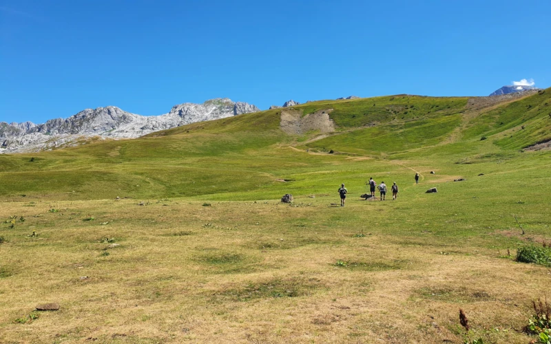
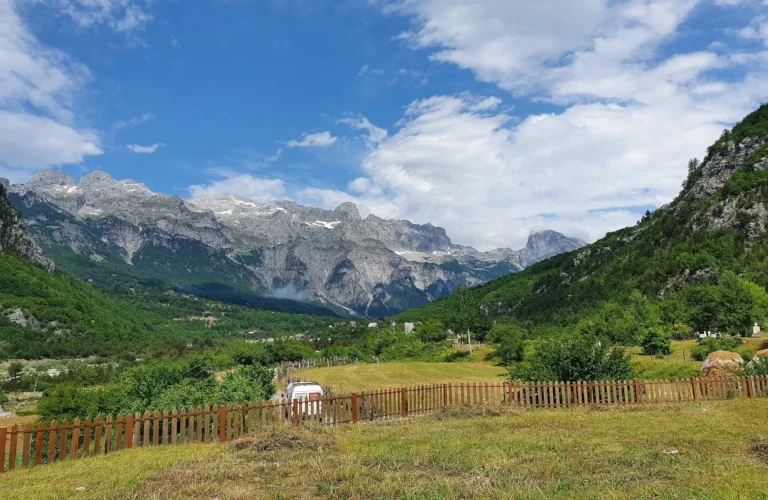
Albania is a paradise for hikers of all levels. Hiking in Albania is an entirely unique experience because you meet super friendly locals, enjoy traditional food, and get introduced to unknown cultures. The mountains in Albania consist of Dinaric Alp, Sar mountains, Pindus mountains, and Ceraunian mountains. The flora of Albania’s nature is rich thanks to the typical Mediterranean climate. From the Albanian Alps down to south Albania, the legends of mountains are exceptional.
Albania’s hiking trails are slightly different from the Western world. They are marked and maintained in the last years but you need to know that the Albanian Alps are pretty wild and harsh. It is highly recommended to hire a private guide while hiking in the Albanian Alps so that you embrace all the beauty of nature and do not miss a thing.
If you prefer to explore the mountains alone, ensure to prepare in advance. Consider assembling all the required equipment for safe and sound walking in Albania. Prior to departure search online about the trail, you plan to hike and download an offline map. Pack good hiking shoes as most of the trails are rocky. Take insulated water bottles and water purification tablets. Also, make a list of local contacts in case of emergency. And most important reduce plastic waste and protect the environment.
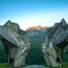
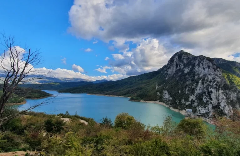
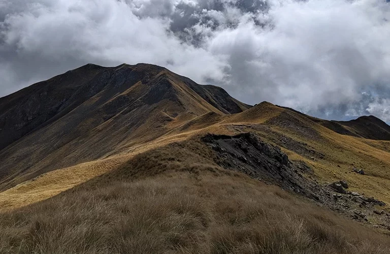
This is perhaps the most famous route in the country. The trail is 16km long and reaches the highest altitude in Valbone ridge at 1800m asl (above sea level). It is open from June – the end of November (depending on the snowfalls). During the winter and spring, the trail is closed due to heavy snow and it becomes dangerous at some point. Even on the warm days of May, the trail has snow and it is not recommended to do it without a local guide. During winter you need to follow the winter trail, which is not well-marked and requires the knowledge of the locals. Along both valleys, the trail stretches through dense beech and pine tree. There are two bars open during summer, where you can enjoy a drink with a view. Level: Moderate
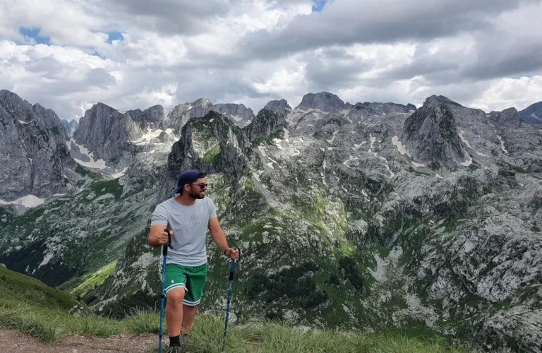
2. Peak of Balkans
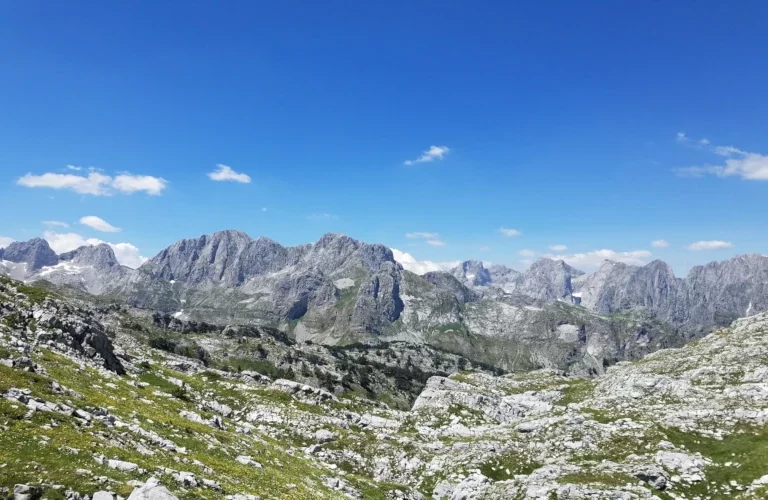
The 192km trail extends through Albania, Kosovo, and Montenegro in the Dinaric Alps. A journey that takes you to some of the most rural villages in these three countries. The Accursed Mountains are wrapped with enormous legends about warriors, kanun, and “zana e maleve” (an Albanian mythological figure associated with mountains). Only in the last 15 years, has the region been accessible to tourists which boosts more the level of adventure. Level: Difficult. For more details about the trail, check out Peak of Balkans
3. Korab mountain
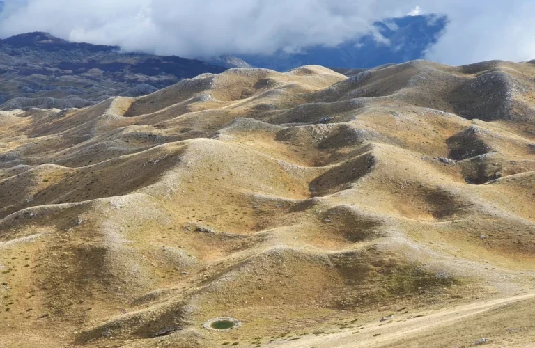
Korab peak is the highest in Albania and North Macedonia standing at 2764m asl. It is located on the border between these two countries and you can reach it from both sides. Korab is the fourth highest peak in the Balkans. The trail in Albania starts from the village of Radomire, and first passes through a pine forest. Then it ascends on a green meadow. The last part is rocky all the way to the summit. It is well-marked in summer (May – November) and in winter is covered with lots of snow. Additionally, it is a great place for ski lovers to slide as the terrain is of easy steepness. Level: Moderate
4. High Scardus Trail
A new trail is built and marked lately which extends along Sar Mountains in Albania, Kosovo, and North Macedonia. The total length is 495km passing between borders of three countries. Whether you can choose to walk the whole trail or divide it into different parts. The region is quite rich in endemic flora and fauna to mention Balkan Lynx, Sar shepherd’s dog, and endemic Macedonian pines. The trail is full of meadows with flowers and glacial lakes. Level: Difficult For more details about the trail, check out High Scardus Trail
This is a beautiful hike nearby the capital Tirana. The peak stands at 1256m asl and it offers amazing views above Lake Bovilla, Mali me Gropa, and Dajti mountain. The trail starts near the lake in the village of Ranze. At first, the route follows through dense bushes and continues up to the rocky part. It is not well marked but it is visible if you have some hiking experience. The views at the top are worth having a picnic. Level: Moderate
6. Mali me gropa
The mountain with holes (that’s the real name) has a rare karstic formation making it a unique hiking experience in Albania. The hiking trail starts from the village of Shen Meri (St. Mary), only a 1-hour drive from Tirana. The first part stretches through an old dirt route, the trail has no signs so you will need to have an offline map or better a local guide. Taking several stops for photos and snacks at the top is worthwhile. Level: Easy
7. Mali i Thate
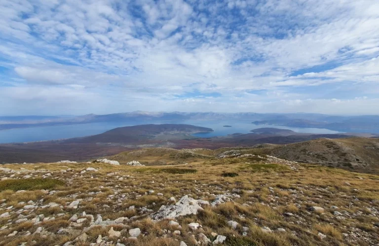
The summit of “Dry Mountain” is approachable following the trail that starts in the village of Alarup in southeast Albania. The route is easy to stick to when having an offline map. It is located between Lake Ohrid and Lake Prespa, where at the top you can admire both of them. There are no trees or water sources on the way, so it is recommended to bring enough water with you. Bear in mind that due to its location, the weather is quite unpredictable and it changes often. Hence strong winds are common on cloudy days. The summit stands at 2288m asl and takes around 7-8 both ways. Level: Easy
8. Tomorr mountain
Tomorr is the most well-known mountain in south Albania and the locals have been hiking around it for centuries. There are two peaks on this mountain, Cuka e Partizanit (2416m) and Baba Tomorri (2400m). Thetrail to “Cuka e Partizanit” starts at “Cezma e Tarikos” south of Berat. The hiking level is moderate and takes around 4-5 hours up to the summit. Baba Tomorri is part of the Bektashism religion and on the top is the shrine of Abbas Ali. This peak is reachable by driving a 4×4 car from Polican and Corovode. From 19-21 of August, there is a big pilgrimage celebration and it’s quite busy with locals.
9. Gramos mountain
“Cuka e Pecit” peak in the Pindus mountain range between Albania and Greece, stands as the highest peak (2520m). It is situated in a remote habited area, covered by green pastures and the main source of four different rivers. The trail starts from the village of Starje in Erseke and lasts for 7 km to the summit. It is a visible track through easy steep hills which takes 3.5-4 hours one way. Level: Moderate
10. Cika peak
In southwest Albania, around Llogara national park you can find many hiking trails. The highest are Qorra (2018) and Cika peak (2044m) on Ceraunian mountain. The trail starts in Llogara pass near Hotel Panorama and continues through a dense pine forest. To reach Qorra peak takes 4km one way and it is of an easy level during the summer period. The trail to Cika peak is 8.6km one way and is considered difficult. It is a rocky terrain and the weather can be quite unpredictable. It is an ultra-prominent track from Qorra to Cika peak, so consider taking a local guide with you. Level: Difficult
11. Nemercka
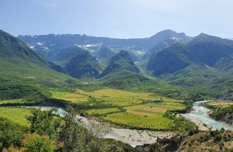
It is located in South Albania and shares the valleys of Vjosa river and Drinos river. The highest peak is “Maja e Papingut” (2485m), which you can reach from both sides. From Vjosa valley it’s quite difficult to climb and you must have great physical conditions and a local guide. For more information, check out: Nemercka from Vjosa valley On the other side of Drinos valley, the route to the summit starts from the village of Skore, near Polican. The trail is approximately 13km long in both ways. For little experienced hikers, it’s recommended to do it during summer or autumn. The trail is covered with snow during winter until late May and requires mountaineering equipment. This is one of the ultra-prominent mountains in Albania, which means that you will gain an elevation of over 1500m. Thus think of oversleeping at the village of the starting point, or camping overnight.
12. Guri i Kamjes
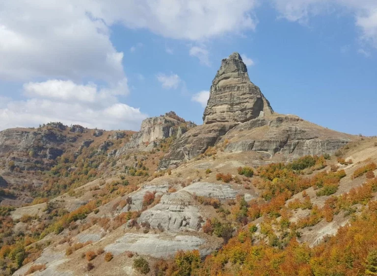
This geological rock stands at 1461 meters above sea level and is created by land erosion and winds. The locals describe it as a large boat sailing in the sea. It is located in the southeast of Albania, between Pogradec and Korce. From Qafe Plloce, turn in the direction of the village of Prenisht. You will need an offroad car as it’s a gravel route. The hiking trail is 4.5 km long and it is easy. It is accessible all year long, even though during winters there is some snow. Please don’t hike up to the rock in order to sustain nature. Level: Easy.
13. Vajusha Peak
It is located in the very north of Albania, right on the border with Montenegro. You can hike to the summit (2050m asl) from the village of Lepushe in Albania. In Montenegro, it is known as Taljanka peak and starts from Grebaj. The trail on the Albanian side is an easy level. It takes around 5 hours to do the whole trail of 10km. The track stretches through a beech forest and mostly in meadows. The route is well marked and you can also find water sources on the way.